Highway 395 Road Trip Stop #3: Manzanar War Internment Camp
- Greg "Star"
- Feb 1, 2024
- 4 min read
Updated: Feb 2, 2024
A road trip can be a transformative experience, especially when the destination is historically significant. In the heart of California's Owens Valley lies Manzanar, a site that invites travelers to examine a chapter of American history often overlooked. Join me on a road trip stop at the Manzanar War Internment Camp, where the journey is not just about beautiful vistas along the road but sometimes uncovering an unpleasant scar on America's landscape.


The first glimpse of Manzanar against the backdrop of the Sierra Nevada Mountains is a sobering scene. Stark remnants of the internment camp where 10,000 Japanese Americans were forcibly relocated during World War II. Reconstructed barracks and the now-vacant watchtower stand as silent witnesses to a time when fear and prejudice masked the principles of “justice for all.” Manzanar was one of ten internment camps. In the aftermath of the attack on Pearl Harbor in 1941, the United States government issued Executive Order 9066. This authorized the forced removal and internment of Japanese Americans, two-thirds of whom were native-born citizens. Families were removed from their homes, losing their businesses, possessions, and, most significantly, their freedom.
Inside the Manzanar Visitor Center are exhibits, displays, photographs and personal accounts of those who faced an unthinkable situation with dignity and strength.


Take a stroll through the reconstructed barracks and explore the remains of a community that, despite the challenges, found ways to create a sense of normalcy. The site's self-guided walking tour allows you to better understand the gravity of the past while appreciating the harshness of the environment.
As I left Manzanar behind and continued my journey on the 395, I reflected on the impact of this stop. I contemplated the importance of rejecting immediate unjust reactions to national crisis and the need to preserve civil liberties and stand against discrimination.
Photography Opportunities
This location offers some unique opportunities for the budding photographer in you.
Some black and white photography with adjustment to the contrast will make for some interesting photographs with the desert and mountains in the background.
As I mention in every post, for warmer colors go out and take photographs in the morning or in the afternoon. The mornings have less haze for sharper images, but sometimes the afternoon haze gives beautiful red-orange skies. I'd recommend avoiding the noon hours for outdoor photos since they tend to come out looking flat, especially if you want people in the photos.
If you have a DSLR then you may want to use a polarizing filter to get a deeper blue sky with contrasting clouds. I find that the skies get washed out easily in the desert. The filter is not as important if you are familiar with post-processing software, such as Adobe Lightroom. For inspiration, take a look at some photos from Ansel Adams and Dorothea Lange that were taken during the war. You can view them using this link - https://www.nps.gov/manz/learn/photosmultimedia/photogallery.htm
Wildlife and Flora
Some of the more common wildlife you may see are: Coyotes, Kit Foxes, Elk, Striped Skunks, Raccoons, Black-Tailed Jackrabbits, Desert Cottontails, Golden Eagles, Bald Eagles and Northern Harriers to name a few.

Golden Eagle
Some interesting plants you may come across are Golden Rabbitbrush used to make gum. Mormon Tea plant, used to make... well tea. Wild Rose also used to make tea and Indian Hemp used to make rope.


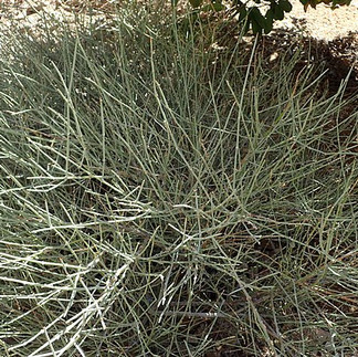


Golden Rabbitbrush Mormon Tea Plant Wild Rose
Map & Guide
National Park Service - Manzanar Website
Check the Manzanar Visitor Center's hours of operation on this link
Cautions according to the National Park Service
Summers at Manzanar are extremely hot. Temperatures frequently exceed 100° Fahrenheit. Strong winds are also common, especially in the spring. Remember to always wear sunscreen and a hat and to drink plenty of water when visiting the site.
Winter at Manzanar is fairly mild although an occasional snowfall is not uncommon. Snow stays on the ground only a few days of the year. However, winds often make it feel colder so you should wear a warm jacket while touring the site.
Nearby Attractions
Continue north to Ancient Bristlecone Pine Forest.
South to Fossil Falls is a short drive down the 395.
Visitor Center: Eastern Sierra Visitor Center (closest town is Lone Pine)
https://www.fs.usda.gov/recarea/inyo/recareaYou more information on these two locations on this website as well.
Accommodations
There are numerous campsites around the towns of Independence and Lone Pine. Do a Google search for campgrounds in the area and you'll see quite a few sites. Free camping is allowed throughout the Alabama Hills.
Here is the official website for the Bureau of Land Management (BLM) Alabama Hills.
As for lodging, there are several hotels in Lone Pine and Independence off highway 395 to choose from.
So, How Do I Get There?
Manzanar National Historic Site
5001 Highway 395
Independence, CA 93526
Coordinates: 36.72739896435374, -118.1528016821575
Los Angeles, CA to Manzanar NHS (~226 miles) Take the Golden State Freeway/I-5 north towards Sacramento. Take CA-14 north toward Lancaster/Palmdale. Remain on CA-14 for 118 miles. Continue on US-395 north for 80 miles. Manzanar is 9 miles north of Lone Pine, CA on the west side of US-395.
Reno, NV to Manzanar NHS (~245 miles) Take US-395 south for 250 miles. Manzanar is 5 miles south of Independence, CA on the west side of 395.
Las Vegas, NV to Manzanar NHS (~262 miles) - through Death Valley National Park Take I-515 north/US-93 north/US-95 north for Ely/Reno for 1 mile. Continue on US-95 for 86.5 miles. Turn on NV-373 for 16.5 miles. Continue on CA-127 for 7 miles. Turn on CA-190 for 115.5 miles Continue on CA-136 for 17 miles. Turn on US 395 north for 12 miles. Manzanar is on the west side of US-395.
Download maps on your phone for areas with no phone data or print a paper copy to bring a long.
Road Closures
Some roads in the area are subject to closure, usually due to weather. Sierra Nevada mountain passes, including Tioga Pass in Yosemite National Park, are closed during the winter. Roads in Death Valley National Park are occasionally closed due to flooding. For current California road conditions, call 1-800-427-7623 or go to the Caltrans Web site.
If you're a history enthusiast or someone seeking an unforgettable educational road trip stop for the family, the Manzanar War Internment Camp should be on your list .
So round up the family and grab the dog. Gather the snacks it’s time to go!
And remember, take photographs and nothing else. :)


Comments